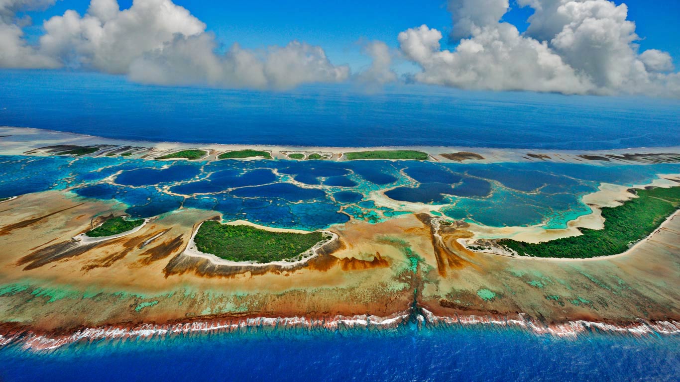
Caroline Island - Its Three Largest Islets
Before the year 2000, Millennium Island was called Caroline Island. It is at the end of the Line Islands in the South Pacific Ocean. This island is part of the Republic of Kiribati, which is made up of 32 atolls and one raised coral island, including Millennium Island. The smaller islets that make up Millennium Island are built on coral reefs.
Author:Jane RestureOct 11, 202217.2K Shares351.9K Views
Before the year 2000, Millennium Island was calledCarolineIsland. It is at the end of the Line Islands in the South Pacific Ocean. This island is part of the Republic of Kiribati, which is made up of 32 atolls and one raised coral island, including Millennium Island.
The smaller islets that makeup Millennium Island are built on coral reefs. The Caroline Islands are in the western Pacific Ocean. They are an archipelago that is mostly made up of atolls.
The largest volcanic islands are Kusaie and Ponape. Palau, Truk, and Yap are the three most important island groups. There are 37 atolls and 963 islands, which together cover 1200 km2 of land (460 sq mi).
What Is Caroline Island?
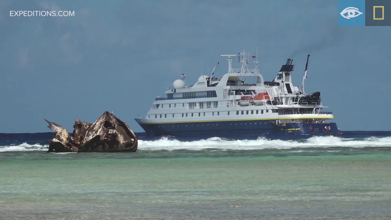
Millennium Atoll | South Pacific | Lindblad Expeditions-National Geographic
Caroline Island, also called Caroline Atoll or Millennium Island, is the most eastern of the uninhabited coral atolls that make up the southern Line Islands in the middle of the Pacific Ocean.
Caroline Island was first seen by Europeans in 1606, was claimed by the United Kingdom in 1868, and has been a part of the Republic of Kiribati since the island nation got its independence in 1979.
The island has stayed mostly untouched and is considered one of the world's most pristine tropical islands, even though it was used for guano mining, copra harvesting, and human habitation in the 19th and 20th centuries.
It has one of the largest populations of coconut crabs in the world and is an important place for seabirds, especially the sooty tern, to nest.
The atoll is best known for its part in the celebrations for the year 2000. In 1995, the International Date Line was moved, which made Caroline Island one of the first places on Earth (other than Antarctica) to see the sunrise on January 1, 2000.
Three Large Islets Of Caroline Island
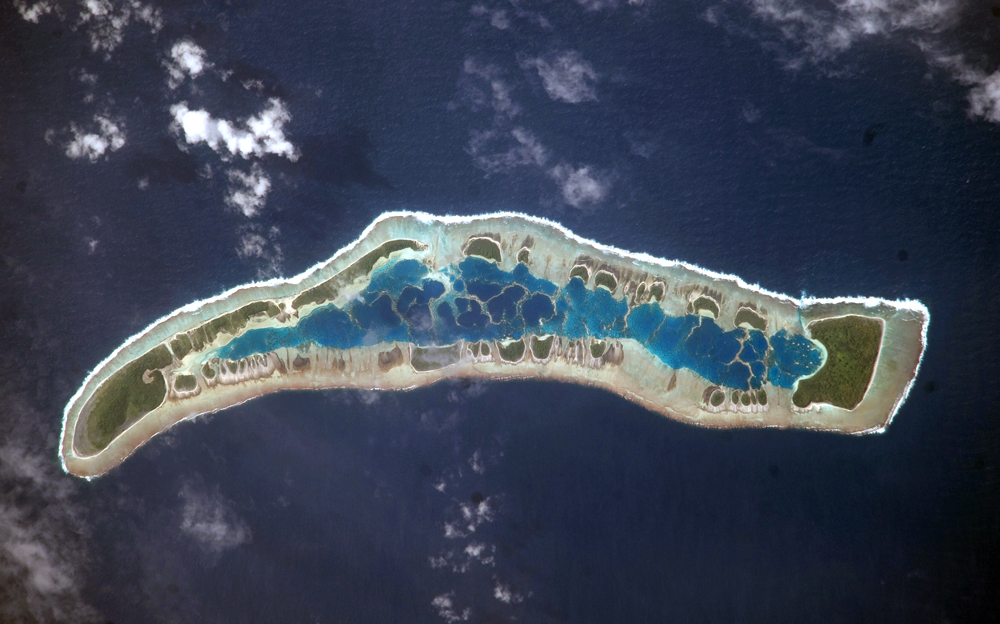
In this picture taken by an astronaut, the islets of Millennium Island stand out as irregular patches of green vegetation around the inner lagoon. The shallow lagoon water is a lighter blue than the deeper ocean water around it.
The "fingers" of corals that you can see in the lagoon are the tops of the corals. The larger part of the atoll is made up of three large islets: Nake Islet, Long Islet, and South Islet. Europeans first saw the beautiful Caroline Atoll in 1606.
In 1868, the United Kingdom claimed them as its own. When the island nation of Kiribati got its independence from the UK in 1979, the Caroline Island atoll became a part of it.
Since there were no people living there, it stayed mostly untouched and is still thought of as one of the most pristine tropical islands in the world, even though guano was mined, copra was harvested, and people lived there in the 19th and 20th centuries.
In 2014, the Government of the Republic of Kiribati put up a 12-nautical-mile fishing ban around each island, including Caroline Island, which was made a wildlife sanctuary.
The island got its new name at the start of the 21st century when the International Date Line was moved. This made the island one of the first places on Earth to see the new year.
The densely forested island is a paradise for the coconut crab, which has one of the largest populations in the world on the island. There are three ring zones of vegetation, though.
The outermost herb mat is usually made up mostly of Heliotropium anomalum. This is followed by a zone of shrubs, mostly made up of Heliotropium foertherianum, and then a forest in the middle, which is usually made up of groves of Pisonia grandis trees.
Many different kinds of seabirds use the beautiful atoll as a place to raise their young. The sooty tern is the most famous of these birds. The green turtle, which is rare and beautiful, nests on the beaches of the islets and comes to the islands quite often.
Biologists are worried about the survival of this Pacific sea turtle because they have heard that poachers have destroyed the nesting sites.
As the island leads the world into the future, there is hope that the reefs, plants, and animals on the untouched islets will still look like the ocean did when it was thriving and full of life.
People Also Ask
What Are The Caroline Islands Called Now?
The atoll's name was temporarily changed to Millennium Island in 1999 when it was advertised as one of the first places on Earth to see the first sunrise of the year 2000. There are no people who live there full-time.v
Does Anyone Live On Caroline Island?
Caroline Island, which is also called Caroline Atoll or Millennium Island, is the most easterly of the uninhabited coral atolls that make up the southern Line Islands in Kiribati, a country in the middle of the Pacific Ocean.
What Islands Are In The Caroline Islands?
Caroline Islands are a group of islands in the western Pacific Ocean. Palau and the Federated States of Micronesiaare made up of islands in this group.
Conclusion
This remote atoll was "discovered" by Europeans for the first time in 1606. This was before European navigators found Tahitior Hawaii. After many more sightings and suggestions of names, she was given the name "Caroline."
As navigators' rhumb lines moved to new places, sailing routes across the Pacific changed, leaving Caroline Atoll and the waters around it mostly alone. Caroline Atoll is now on the edge of the International Date Line.
It is a small, isolated island that leads the rest of the world into the future. Caroline Island is now protected as a marine reserve.
Jane Resture
Author
Since she embarked on her first world trip in 2002, Jane Resture spent the past decades sharing her personal journey and travel tips with people around the world. She has traveled to over 80 countries and territories, where she experienced other cultures, wildlife she had only read about in books, new foods, new people, and new amazing experiences.
Jane believes that travel is for everyone and it helps us learn about ourselves and the world around us. Her goal is to help more people from more backgrounds experience the joy of exploration because she trusts that travel opens the door to the greatest, most unforgettable experiences life can offer and this builds a kinder, more inclusive, more open-minded world.
Latest Articles
Popular Articles