Nukunonu - The Largest Atoll In Tokelau
Tokelau, a New Zealand dependency in the South Pacific Ocean, has the coral atoll of Nukunonu. It has 30 islands that surround a lagoon that is 8 miles by 7 miles. The island was discovered in 1791 and given the name Duke of Clarence Island by the captain of the British ship Pandora, which was looking for HMS Bounty mutineers.
Jane RestureSep 30, 202252 Shares1408 Views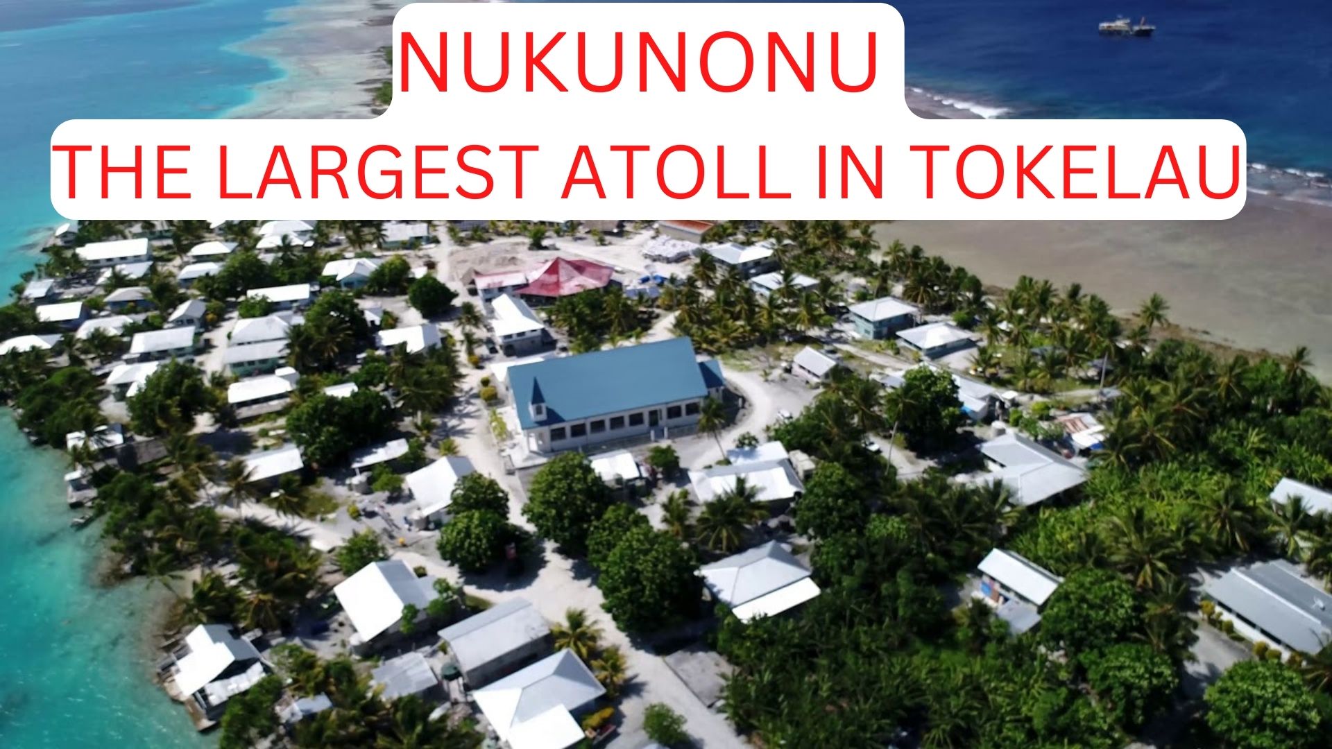

Tokelau, a New Zealand dependency in the South Pacific Ocean, has the coral atoll of Nukunonu. It has 30 islands that surround a lagoon that is 8 miles by 7 miles. The island was discovered in 1791 and given the name Duke of Clarence Island by the captain of the British ship Pandora, which was looking for HMS Bounty mutineers.
Before 1858, a Samoan missionary converted Nukunonu's inhabitants to Roman Catholicism. Coconuts, pandanus, and marine life are the islanders' primary sources of food; fresh water is in short supply.
The absence of a suitable harbor hinders shipping. A Taupulega (Council of Elders), which consists of two elected members and the leaders of family groupings, serves as the local government. 1.8 miles (4.7 square kilometers).
Nukunonu Culture
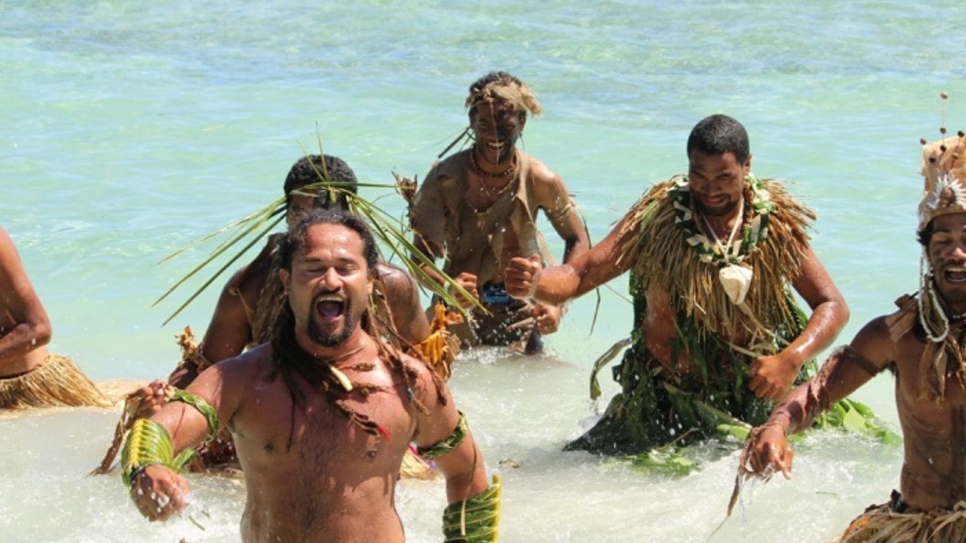
The culture of the Nukunonu is Polynesian. Sharing resources by needs and respect for elders are fundamental aspects of Nukunonu culture. The degree of employment is often determined by age, with older Tokelauans holding managerial positions.
Men are mostly involved in fishing, farming, and construction in the division of labor, while women are responsible for maintaining the villages. However, many Nukunonuans work in the public sector, where such lines between racial groups are often blurred.
Mоst оf the land is managed by kin groups. Many Nukunonus are part of multiple kin groups. Essentially all Tоkelаuаns have rights tо land and а share оf the produce оf the land. Land can be transferred to other Tokelauans, but it cannot be transferred to outsiders. Each atoll is made up of a single village.
Festivals And Events
ChristmasDay, Boxing Day, New Year's Day, Good Friday, Easter Monday, Tokehega Day, and any other day designated as a public holiday by a village are examples of public holidays. While Waiting Day and, two New Zealand public holidays, are observed in Tokelau.
Although, they are not recognized as official holidays. On September 3, which marks the day the Treaty of Tokehega went into force, people commemorate Tokehega Day.
The Language Of The Nukunonu Island
Although English is widely spoken and understood, Tokelauan, a Polynesian language related to Samoan and Tuvaluan, is the native tongue. The phrase "northern wind" is a Polynesian origin for the name Tokelau.

Nukunonu Tokelau (hidden Paradise)
What About Tourism In Nukunonu?
Due to the undeveloped tourism industry on its islands and the extensive boat travelrequired to get there, Nukunonu tourism is not very well-developed. The majority of visitors to Nukunonu are either native Tokelauans or those who are there to see friends and family.
Scuba diving and snorkeling are the main pastimes in the lagoons. When there is a special event, like a holiday or pageant, tourists might be exposed to activities like traditional singing and dancing.
People Also Ask
Where Is Nukunonu Located?
In Tokelau, a New Zealand dependency in the South Pacific Ocean.
How Many People Live In Nukunonu?
Nukunonu has a total of 385 typical inhabitants, 45.7 percent were born there.
What Is Nukunonu Famous For?
Nukunonu is famous because it has the smallest economy of any sovereign nation in the world, but it is a leader in renewable energy sources.
Conclusion
The largest of the three atolls that make up Tokelau, Nukunonu, has 24 islets. Additionally, it is endowed with a wealth of pandanus trees for weaving and has the biggest lagoon. The other main feature of the atoll is the extremely pragmatic village hall, which is a cargo shed.
Nukunono was once home to a finely built Polynesian population, as evidenced by the fact that they gave the first settler of Fakaofu a wife. All but a handful of these early people were exterminated or driven away by invaders from Fakaofu, under a ruler called Te Vaka, in approximately 1650.
Latest Articles
Popular Articles